![](/images/other/stat-length.png)
![Randonnée V.T.T. Le Cergne - La Rando VTT des Sapeurs Pompiers - Le Cergne - Photo](https://media.geolcdn.com/t/1900/400/ext.pjpeg?maxdim=2&url=https%3A%2F%2Fservices.sitytrail.com%2FGeolivesWS%2FDownloadMedia.ashx%3FTrailID%3D106625%26Media%3D11235_6.jpg)
La Rando VTT des Sapeurs Pompiers - Le Cergne
tracegps
Utilisateur
![Longueur](/images/other/stat-length.png)
![Altitude max](https://static1.geolcdn.com/siteimages/upload/files/1508320355ic_sort_altitude_max_24dp.png)
![Dénivelé positif](https://static1.geolcdn.com/siteimages/upload/files/1508320355ic_sort_den_pos_24dp.png)
![Km-Effort](/images/other/stat-length.png)
![Altitude min](https://static1.geolcdn.com/siteimages/upload/files/1508320355ic_sort_altitude_min_24dp.png)
![Dénivelé négatif](https://static1.geolcdn.com/siteimages/upload/files/1508320355ic_sort_den_neg_24dp.png)
![Boucle](https://static1.geolcdn.com/siteimages/upload/files/16400158638029165_repeat_loop_refresh_sync_direction_icon.png)
![V.T.T.](https://static1.geolcdn.com/sitytour/trail-icons/202.png)
2h30
Difficulté : Très difficile
![Scannez ce code QR pour ouvrir la randonnée dans l'application SityTrail](https://capi.geolives.com/qq0zvz2zws4bq2lad0pu/sitytour/trails/106625/qr.png?size=200)
Application GPS de randonnée GRATUITE
À propos
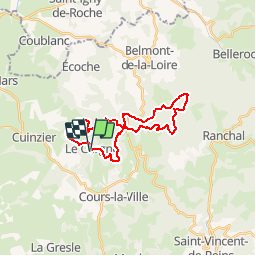
Randonnée V.T.T. de 25 km à découvrir à Auvergne-Rhône-Alpes, Loire, Le Cergne. Cette randonnée est proposée par tracegps.
Description
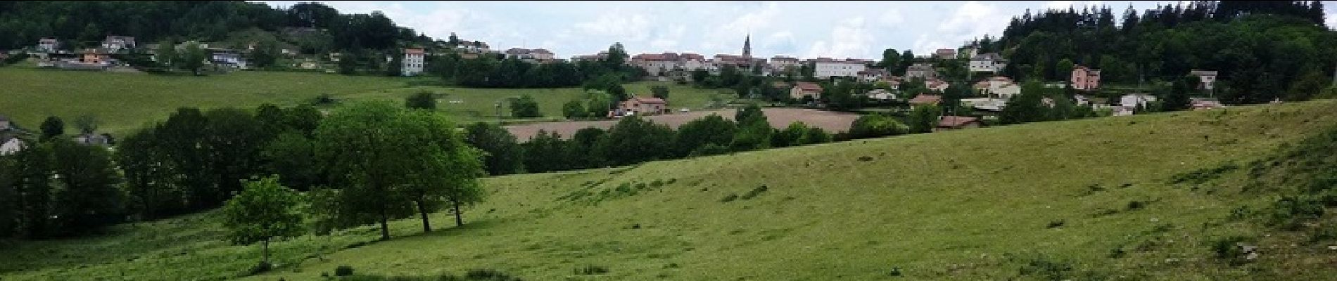
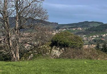
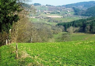
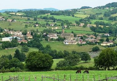
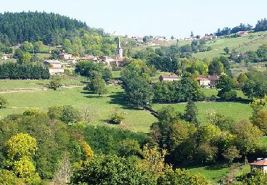
Parking et départ de la Mairie (à côté de la caserne des pompiers). Organisateurs : l'amicale des sapeurs pompiers du Cergne. En parallèle au "Championnat de la Loire VTT Sapeurs Pompiers" une randonnée était ouverte le matin sur une boucle de 25 km dans les sous-bois vallonnés autour de la commune du Cergne. La Compétition des Sapeurs Pompiers se déroulait l'après-midi sur un parcours indépendant (boucle de 8 km à faire 3 fois). Cette boucle est absolument magnifique de par la beauté de ses sous-bois et de ses sentiers dans le massif du Beaujolais. Ne pas se fier à la distance qui n'est que de 25 km car ce parcours est costaud, hyper technique et cassant (il y a du poussage)... il désenchantera les pratiquants occasionnels ! Normal ce circuit a été tracé non pas à VTT mais à moto et forcement ça passe beaucoup mieux avec un engin motorisé. Topoguide : Le Pays de Bellemont-de-la-Loire à pied (16 circuits entre Roannais et Beaujolais).
Localisation
Commentaires
Randonnées à proximité
![Randonnée V.T.T. Cours - VTT autour de Thel et Ranchal - Cours la Ville - Photo](https://media.geolcdn.com/t/375/260/ext.jpg?maxdim=2&url=https%3A%2F%2Fservices.sitytrail.com%2FGeolivesWS%2FDownloadMedia.ashx%3FTrailID%3D173231%26Media%3D14836_6.jpg)
![V.T.T. V.T.T.](https://static1.geolcdn.com/sitytour/trail-icons/202.png)
V.T.T.
![](/images/other/stat-length.png)
![](https://static1.geolcdn.com/siteimages/upload/files/16400158638029165_repeat_loop_refresh_sync_direction_icon.png)
![Randonnée Marche Écoche - Écoche : de crête en crête - Photo](https://media.geolcdn.com/t/375/260/331e675f-4e89-4001-b2a6-773e745620a4.jpg&format=jpg&maxdim=2)
![Marche Marche](https://static1.geolcdn.com/sitytour/trail-icons/101.png)
Marche
![](/images/other/stat-length.png)
![](https://static1.geolcdn.com/siteimages/upload/files/16400158638029165_repeat_loop_refresh_sync_direction_icon.png)
![Marche Marche](https://static1.geolcdn.com/sitytour/trail-icons/101.png)
Marche
![](/images/other/stat-length.png)
![](https://static1.geolcdn.com/siteimages/upload/files/16400158638029165_repeat_loop_refresh_sync_direction_icon.png)
![Randonnée Marche Cuinzier - Cuinzier : Entre Chandonnet et Jarnossin - Photo](https://media.geolcdn.com/t/375/260/b994b5c1-04fb-4985-a1e3-371b0add3bde.jpg&format=jpg&maxdim=2)
![Marche Marche](https://static1.geolcdn.com/sitytour/trail-icons/101.png)
Marche
![](/images/other/stat-length.png)
![](https://static1.geolcdn.com/siteimages/upload/files/16400158638029165_repeat_loop_refresh_sync_direction_icon.png)
![Randonnée Marche La Gresle - La Gresle : d'une colline à l'autre - Photo](https://media.geolcdn.com/t/375/260/405d03cf-fd22-460f-809d-8d95bce68489.jpg&format=jpg&maxdim=2)
![Marche Marche](https://static1.geolcdn.com/sitytour/trail-icons/101.png)
Marche
![](/images/other/stat-length.png)
![](https://static1.geolcdn.com/siteimages/upload/files/16400158638029165_repeat_loop_refresh_sync_direction_icon.png)
![Randonnée V.T.T. Arcinges - 3ème Randonnée VTT en Pays de Belmont de la Loire (2013-VTT-40km) - Arcinges - Photo](https://media.geolcdn.com/t/375/260/ext.jpg?maxdim=2&url=https%3A%2F%2Fservices.sitytrail.com%2FGeolivesWS%2FDownloadMedia.ashx%3FTrailID%3D317115%26Media%3D16265_6.jpg)
![V.T.T. V.T.T.](https://static1.geolcdn.com/sitytour/trail-icons/202.png)
V.T.T.
![](/images/other/stat-length.png)
![](https://static1.geolcdn.com/siteimages/upload/files/16400158638029165_repeat_loop_refresh_sync_direction_icon.png)
![Randonnée V.T.T. Arcinges - 2ème Randonnée VTT en Pays de Belmont de la Loire (2012-VTT-45km) - Arcinges - Photo](https://media.geolcdn.com/t/375/260/ext.jpg?maxdim=2&url=https%3A%2F%2Fservices.sitytrail.com%2FGeolivesWS%2FDownloadMedia.ashx%3FTrailID%3D172912%26Media%3D14373_6.jpg)
![V.T.T. V.T.T.](https://static1.geolcdn.com/sitytour/trail-icons/202.png)
V.T.T.
![](/images/other/stat-length.png)
![](https://static1.geolcdn.com/siteimages/upload/files/16400158638029165_repeat_loop_refresh_sync_direction_icon.png)
![Randonnée V.T.T. Mars - VTT de Mars à Juin... - Photo](https://media.geolcdn.com/t/375/260/ext.jpg?maxdim=2&url=https%3A%2F%2Fservices.sitytrail.com%2FGeolivesWS%2FDownloadMedia.ashx%3FTrailID%3D172616%26Media%3D13982_6.jpg)
![V.T.T. V.T.T.](https://static1.geolcdn.com/sitytour/trail-icons/202.png)
V.T.T.
![](/images/other/stat-length.png)
![](https://static1.geolcdn.com/siteimages/upload/files/16400158638029165_repeat_loop_refresh_sync_direction_icon.png)
![Randonnée V.T.T. Arcinges - 1ère Randonnée VTT en Pays de Belmont-de-la-Loire (25 km) - Arcinges - Photo](https://media.geolcdn.com/t/375/260/ext.jpg?maxdim=2&url=https%3A%2F%2Fservices.sitytrail.com%2FGeolivesWS%2FDownloadMedia.ashx%3FTrailID%3D107335%26Media%3D12225_6.jpg)
![V.T.T. V.T.T.](https://static1.geolcdn.com/sitytour/trail-icons/202.png)
V.T.T.
![](/images/other/stat-length.png)
![](https://static1.geolcdn.com/siteimages/upload/files/16400158638029165_repeat_loop_refresh_sync_direction_icon.png)